
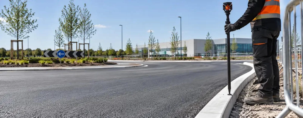
Land Surveyors in Brighouse
Get in TouchAt TerraTrace Surveys, we provide comprehensive land surveying services in Brighouse and the wider HD6 1 area. Our team delivers precision and accuracy through various methods including topographic, boundary, and site surveys.
We use modern equipment to identify and map land features for property development, construction projects, and legal disputes. Contact us today to discuss your land surveying needs in Brighouse.
What Is Land Surveying?
Land surveying is the process of measuring and mapping land sites with precision. At TerraTrace Surveys, we conduct comprehensive land surveys in Brighouse to determine boundaries, establish levels, and mark out construction areas.
Our services cater to a variety of client needs, from residential property assessments to large-scale infrastructure projects. We employ a range of surveying methods, including Global Navigation Satellite System (GNSS) for satellite-based measurements, total stations for accurate distance and angle calculations, and 3D laser scanning for detailed spatial data collection.
These techniques are essential for property development, infrastructure planning, and legal purposes, such as resolving boundary disputes or facilitating land division. Our surveys adhere to industry standards and regulations, ensuring reliable results for our clients.
Contact us to learn more about how our land surveying services can assist your next project.
How Much Does Land Surveying Cost in Brighouse?
Land surveying in Brighouse typically costs between £400 and £1,200 depending on the survey type and site size. The cost is influenced by factors like site accessibility, terrain complexity, and the data level required.
For example, boundary surveys may cost less than detailed topographic surveys due to the scope of work involved.
We also consider the use of specialised equipment like GPS systems and robotic total stations, which can enhance accuracy. The presence of existing structures or vegetative cover on the site might necessitate additional work, affecting the overall cost.
Additionally, any need for compliance with specific planning regulations or the provision of legal documentation will be taken into account.
Our team can conduct surveys for a variety of properties, including residential plots, commercial developments, and agricultural land. Contact us to obtain a detailed quote specific to your project requirements.
Why Choose TerraTrace Surveys for Land Surveying in Brighouse?
Choosing TerraTrace Surveys for your land surveying needs in Brighouse ensures accuracy and reliability. Our surveyors are skilled in using advanced equipment such as total stations and GPS. We also implement laser scanning technology to capture detailed topographical data and aerial drones for comprehensive aerial surveys, which are particularly useful in assessing larger or difficult-to-access areas.
We cater to both residential and commercial clients, delivering outputs compliant with UK land regulations, including RICS standards. Our services cover boundary surveys, construction layout, and topographic mapping, helping to identify any potential legal or planning issues early in the process.
Our survey reports are meticulously prepared, ensuring they meet the specific requirements for planning applications and property purchases. Engage us for your project to benefit from precise and timely survey results.
What Types of Land Surveys Are Available in Brighouse?
We offer various land surveys in Brighouse to meet diverse needs, using specialised equipment and techniques to ensure accuracy.
Topographic Surveys: Detailed mapping of land features like trees, buildings, and surface levels, often using total stations and GPS. This is essential for architects and engineers during site design to understand existing conditions and elevations.
Boundary Surveys: Establishes precise property lines and demarcations, ensuring compliance with local zoning laws and property deeds. Legal land descriptions are refined and verified to prevent disputes.
Site Surveys: Covers construction sites to guide planning and development. This includes measuring existing structures, documenting topographical changes, and is pivotal for obtaining planning permissions.
Utility Surveys: Detects underground utilities and services before excavation, using ground-penetrating radar (GPR) and electromagnetic location techniques. This prevents accidental damage during construction projects.
These surveys are vital for ensuring project accuracy and legal compliance. Get in touch to determine the right survey type for your situation.
How Does Land Surveying Work?
The land surveying process involves several steps essential for creating precise and reliable measurements critical for construction, development, and land division projects.
Consultation: We begin by discussing the client's requirements and goals, measuring specific needs like boundary demarcation or topographical mapping.
Planning: A thorough plan is developed to determine the most appropriate surveying techniques, such as GPS surveying, laser scanning, or drone photogrammetry. We also schedule fieldwork considering site accessibility and weather conditions.
Data Collection: Our teams use specialised equipment, including total stations, GNSS receivers, and unmanned aerial vehicles, to collect comprehensive site data with pinpoint accuracy.
Analysis: The collected data is processed using software such as AutoCAD Civil 3D and GIS systems to analyse and model terrain and boundaries.
Reporting: We compile our findings into detailed reports and plans, adhering to industry standards like RICS and providing clear visual representations of site features.
We pride ourselves on a methodical approach for each project, ensuring accuracy and compliance. Contact us to discuss your property requirements today.
Speak to a Land Surveyors Expert
What Are the Benefits of Land Surveying in Brighouse?
Land surveying in Brighouse provides numerous benefits, ensuring informed decision-making and risk management for various types of properties, whether residential, commercial, or industrial.
Accurate Boundaries: We use advanced equipment like total stations and GPS systems to provide precise boundary definitions, preventing costly legal disputes and ensuring compliance with Land Registry standards.
Planning Aid: Professional surveys support designing layouts and infrastructure by determining elevations, contours, and existing features. This is crucial for civil engineers and architects during the planning stages.
Valuation Support: Land surveys provide critical data on plot dimensions and topography, which informs property valuation and sales for estate agents and developers.
Risk Reduction: By identifying potential land issues such as flood risk, soil stability, and underground utilities, our surveys can help mitigate risks before construction, saving both time and expense.
Let us assist you in reaping these benefits for your land project.
Frequently Asked Questions
What is the duration of a typical land survey in Brighouse?
Surveys generally take one to three days to complete, but this can vary depending on site size and complexity. We advise booking early to accommodate your project timeline.
Are your surveyors licensed?
Our surveyors are qualified and experienced, operating in compliance with UK standards. However, licensing requirements will depend on specific project needs.
What information is included in a land survey report?
A land survey report includes site plans, boundary markers, topographic features, and other critical details like easements or existing buildings.
How do I prepare for a land survey?
Ensure site access is possible and provide any existing plans or documents. Clear the area of obstructions where possible for accurate surveying.
Can you conduct surveys for large commercial projects?
Yes, TerraTrace Surveys handles surveys for both residential and commercial projects, regardless of size. Contact our team to discuss your specific project needs.
Get a Free Quote for Land Surveying in Brighouse
Reach out to us today to discuss your land surveying needs. Contact us for a professional, reliable survey in Brighouse.
We cover Brighouse (West Yorkshire)