
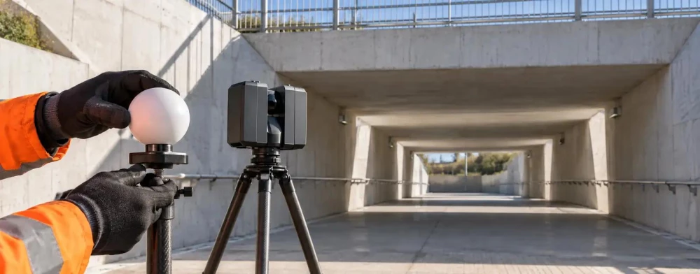
Laser Scanning Surveyors in Doncaster
Get in TouchAt TerraTrace Surveys, we specialise in laser scanning surveyor services across Doncaster and the surrounding DN1 1 area. Our precise 3D laser scanning technology captures detailed spatial data, providing accurate measurements for construction, architecture, and civil engineering projects.
Using state-of-the-art equipment, we ensure efficient data collection for a range of structures and terrains. Contact us today to arrange a high-precision survey.
What Is a Laser Scanning Survey?
A laser scanning survey is a technology-driven method for capturing accurate 3D data of physical environments and structures. At TerraTrace Surveys, we use advanced laser scanners to measure and record spatial data efficiently.
Our scanners can capture millions of individual measurements per second, providing comprehensive point cloud data of the surveyed area.
This method allows us to create precise digital models and point clouds, which are essential for engineering, construction, and design projects in Doncaster. The data we gather is integral to Building Information Modelling (BIM), enabling architects and engineers to make informed decisions about building design and maintenance.
Laser scanning surveys are particularly beneficial for renovations, heritage site restoration, and as-built documentation. Our team is equipped to handle various projects, including urban planning and infrastructure development, ensuring that clients receive detailed and actionable insights for their specific needs.
Contact us to learn how our services can support your next project in DN1 1.
Book Laser Scanning Surveyors Today
How Much Does a Laser Scanning Survey Cost in Doncaster?
Laser scanning surveys typically cost from £1,000 to £3,000 in Doncaster depending on the project's complexity and size. Several factors influence the price: the area to be scanned, required level of detail, and specific site conditions all play a role.
For instance, larger industrial sites or multi-storey buildings may require additional time and resources, increasing the cost. The choice of scanning equipment, such as the Leica RTC360 or FARO Focus, can also affect pricing depending on the precision needed.
Additionally, compliance with local building regulations or historical preservation standards might necessitate more detailed scans. Our team provides tailored quotes based on your unique requirements, ensuring all specifications and industry standards are met.
Reach out to us for a customised quote today.
Why Choose TerraTrace Surveys for Laser Scanning in Doncaster?
Choosing TerraTrace Surveys for laser scanning in Doncaster ensures expertise, precision, and reliable results. Our experienced team uses the latest 3D laser scanners, such as the Faro Focus and Leica BLK360, to deliver high-resolution data efficiently.
These tools capture millions of data points per second, providing detailed measurements with millimetre accuracy. We adhere to industry standards like the PAS 128 for underground utilities and BIM Level 2 for construction projects, ensuring our data is compatible for architectural, engineering, and construction purposes.
Given the complexity of modern projects, we handle a wide range of property types, from historical buildings needing heritage conservation to large commercial developments requiring precise spatial data. We provide comprehensive data analysis and reports to facilitate informed decision-making, including point cloud processing and 3D model generation using software like AutoCAD and Revit.
Our commitment to accuracy and client satisfaction makes us a preferred choice. Contact us today to experience our service.
What Are the Benefits of a Laser Scanning Survey in Doncaster?
A laser scanning survey offers numerous benefits in Doncaster:
High Accuracy: Capture detailed measurements with millimetre precision, essential for constructing precise building models and verifying design tolerances.
Speed: Efficient data collection reduces time on-site, facilitating quicker project turnaround and minimising delays. For example, capturing up to 1 million data points per second allows for rapid scanning.
Comprehensive Data: Obtain a complete 3D model of the site or structure, which can be integrated into Building Information Modelling (BIM) systems to enhance planning accuracy.
Versatility: Suitable for diverse projects, including construction, heritage, and infrastructure, as well as urban planning and utility mapping.
Non-Intrusive: Conduct surveys without disrupting the site or environment, making it ideal for sensitive historic sites adhering to conservation regulations.
Exploring these benefits can help optimise your project outcomes. Contact us today to learn more.
Speak to a Laser Scanning Surveyors Expert
Frequently Asked Questions
What is the typical turnaround time for a laser scanning survey?
A laser scanning survey in Doncaster typically takes one to two weeks from initial survey to final report, depending on the project's size and complexity.
Can laser scanning surveys be used for historical buildings?
Yes, our laser scanning technology is ideal for preserving details of historical buildings in Doncaster. It captures intricate architectural features without causing damage.
Is laser scanning suitable for outdoor environments?
Absolutely. Our equipment is designed to handle various outdoor conditions in Doncaster, providing reliable data for different terrains and weather.
How do I schedule a laser scanning survey?
To schedule a laser scanning survey, contact our team directly. We will discuss your needs and arrange a convenient time for the survey in Doncaster and the DN1 1 area.
Get a Free Quote for Laser Scanning Surveyors in Doncaster
For professional laser scanning surveyor services in Doncaster, reach out to TerraTrace Surveys. We offer precise measurement solutions tailored to your project needs.
We cover Doncaster (South Yorkshire)